
As ever, Lakes of the Clouds Hut provides a wonderful base
from which to explore Bigelow Lawn, the plateau that lies on the south side of
the Mount Washington summit cone. In late June, Ari Ofsevit, last fall’s
hutmaster at Lakes and an old hiking pal, and I hiked up the Ammonoosuc Ravine
Trail and then went on a leisurely botanical ramble around the summit. Despite
the scores of people coursing up and down the Crawford Path and Tuckerman
Ravine Trail, the Lawn, which lies between the two, was deserted.

Ari suggested that we look for the old shelter that was
built in 1900 for William Curtis and Allan Ormsbee, two members of the AMC who
perished near the lakes the previous year on their way to the club’s annual
meeting at the summit. Both were known for their experience and fitness, so
their death convinced club members to construct a shelter in the vicinity of
the area where they expired. I had thought that the shelter was built on the
site of the current hut, but in fact the AMC placed it about a third of a mile
further up the ridge, well beyond the lakes. The picture above shows why: since
the original Crawford Path ran around Mount Monroe to the east, a trip to the
lakes would have necessitated a detour that included a slight descent (the precursor to the modern hut was built in 1915 - hundredth anniversary is next summer!). Indeed,
Ari speculated, rightly in my opinion, that much of the Dry River Trail’s route
before it ducks into Oakes Gulf, was probably once part of the Crawford Path.
Both trails have required rerouting to avoid the delicate habitat of the Dwarf
Cinquefoil on Monroe Flats, which was devastated by the foot traffic.


Little remains of the original shelter save for a pair of
iron rods and bolts that reinforced the wooden structure. A couple piles of
rock that must once have been cairns lie nearby, as well. A nearby view towards
the lower lake provides a sense of size the watershed that is responsible for the upper lake’s
existence.

Though Monroe, the hut, and the lakes are often photographed from higher up on the Crawford Path, I've never seen a picture from this perspective.
Returning to the site of the old shelter, we noticed the
remnants of the old treadway, lightly overgrown but still
visibly impacted. It intersected very quickly with the Camel Trail. However, we
knew the concurrence could not last for long if the trail were to climb towards
Washington. Sure enough, we caught sight of the old Crawford Path splitting off
a few yards further on. We resolved to follow it, taking care to hop from rock
to rock.


Though we lost sight of the old trail here and there, we
were able to track it all the way to its old junction with the Davis Path, with
which it coincided, I believe, up to the summit. As the picture above shows, Diapensia and other species have filled in some of the path, but the trail is still bare in some stretches. Its endurance is a testament
to the harshness of the climate in the alpine zone and the need to minimize
human impacts.

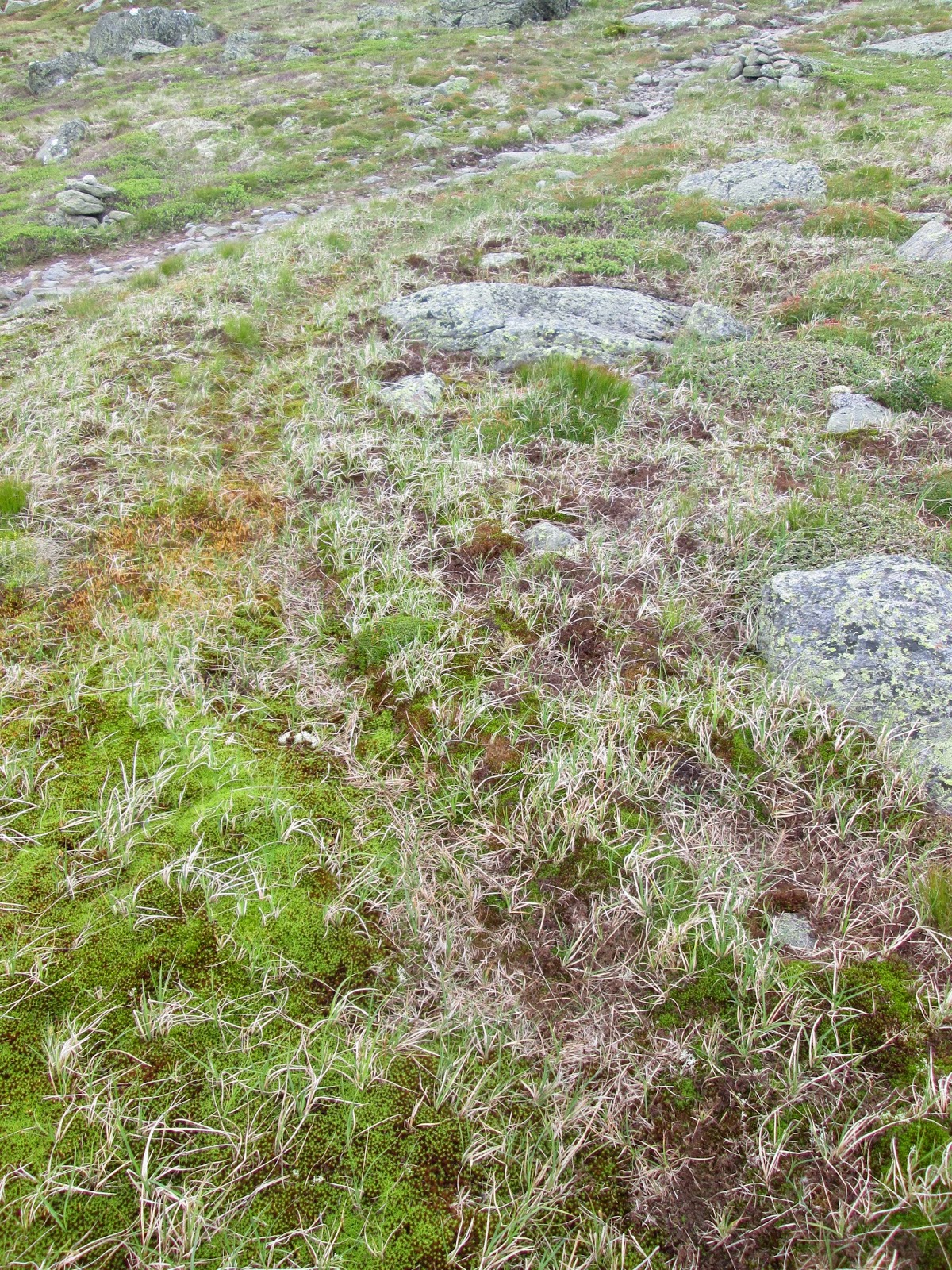
After a spell, we came across this bare patch, which to my eye is a less-developed example of the soil striping that characterizes Monroe Flats.

Interesting arc the old path cuts up this slope.


One of the distinct pleasures of carefully following this old path was to gain a new perspective on the alpine zone. Bigelow Lawn is a particularly beautiful area in the Presidentials - big, broad, and well-vegetated, unlike the summit cone of Washington. Ari and I had ample time to examine the local flora here and in the Alpine Garden farther on along the east side of the mountain.

First, however, we needed to cut across the rim above Tuckerman Ravine. As we crossed the Tuckerman Ravine Trail, we looked up to see this queue of hikers running up to the summit. Ari counted seventy or eighty people in a brief glance.

Further along, we came across Mountain Heath. I hadn't identified this plant before. Lovely, delicate flowers.

Good old Diapensia.

Mountain Heath. Such wonderful clusters of blossoms.

Ready for its close-up, apparently. It was too late in the season for Lapland Rosebay, but I was glad to see these pink beauties.

Mountain Bluets, which I first confused with the more common Mountain Sandwort.

Mountain Avens, which was in full bloom in the Alpine Garden. Spots of yellow everywhere.

A very lush streamside community toward the north end of the Alpine Garden. It's right along the trail.

This vernal pool is actually on Bigelow Lawn, near the Camel Trail, but it's another interesting example of how plants cluster near water sources. We came across the Mountain Heath here, actually, rather than on the Alpine Garden. The pool was swollen with recent rain and probably often dries up by midsummer.

Here we look back at the Alpine Garden as we began to hike up to Nelson Crag. This is one of the few spots in the Whites where the scenery gains an extra degree of scale, more like a feature that one would find out west or in the lower Alps. What a day! We had plenty more mileage to cover to return to our car at the base of the Ammy, but there were fewer points of interest to capture my camera's attention.