Thursday, October 14, 2010

Beaver at Norcross Pond

Over the Columbus Day weekend, I flew up to New Hampshire, while my old pal from the huts, RD Jenkinson, drove over from Middlebury to meet me at the Manchester airport. RD and I worked at Mizpah (the Black Pah) in the fall of 2006, when we bonded over dressing up in drag to entertain hut guests and traversing the Presidentials at night to raid Madison and Lakes.

RD’s family recently bought a house up in North Conway, so we spent our first night there rather than hike up in the dark to Greenleaf, where we were meeting another friend of mine who has appeared in these annals. As we had some time to play with on Saturday morning, we hiked up the Nancy Pond Trail to Norcross Pond, which sits on a plateau between Mounts Nancy and Anderson at the eastern edge of the Pemigewasset Wilderness.

The Nancy Pond Trail was first cleared in 1938—the year of the Hurricane of ’38. Little of the trail remained in the wake of the storm. The next year, the Lucy family built a mill about halfway up to Nancy Cascades to salvage some of the downed timber, but little else happened along the old path until the sixties, when Camp Pasquaney, thanks to an extraordinarily energetic and hard-working counselor named Dave Ryder, reopened the old trail. He still works at camp, running the wood shop. When I was a camper, he was known for demonstrating the sharpness of an ax by using it to shave his arm hair.

I attended Pasquaney for five summers as a camper and returned for another five as a counselor. During seven of those summers, I spent five days in early July on ten man expeditions doing trail maintenance along the Nancy Pond Trail. Often we would camp by Norcross Pond, which empties to the west, into the Pemigewasset watershed. The stream has scoured a series of rock ledges, which are a good place to drop one’s pack and gaze west at the Bond Range. It is an ideal place to cook and sit around with your group.

One year, when I was leading an expedition in the region for the first time with an older counselor named Trey Winstead, one of the boys, a thirteen year old who was particularly energetic and mischievous, grabbed a grub hoe and ran off to dig in the mud holding back the pond behind us. Trey and I exchanged glances, relieved to have the boy occupied while dinner cooked. A few minutes later, however, a sheet of water washed over the ledges where we sat, and it did not abate. Luckily, the camper was able to put things back to right, but the pond had lost a couple of inches.

More recently, beavers recolonized Norcross Pond, for the first time, I believe, in camp memory. The lake now sits several feet higher than it used to, and much of the old trail that ran around the lake is now submerged. Last year, the Forest Service, assisted by Pasquaney, rerouted the trail to higher ground and installed dozens of new bog bridges. In the old days, camp might have handled all the work itself, but I am glad that we are now focusing on what we can do best (keeping the trail clear), leaving the heavy work to professionals.


Our hike was on a cool, crisp day—the best of New England fall. By the edge of the pond, the wind was swift and steady, forcing us to seek shelter in the forest while we ate lunch. In addition to the dam, the beavers have constructed a substantial lodge on the north side of the pond. Like the dam, it looks solid and well maintained.

Beavers have been on the move all over the Whites recently. I believe they have resumed activities in the Zealand Valley since I worked at the hut in 2008, causing some flooding to the trail there, too. Alex MacPhail included a photo on his blog not long ago of a metal pipe someone had stuck through a dam to improve drainage. When I was the naturalist at Zealand, I gave a program, usually to younger visitors, called “Our friend, the beaver,” for which I learned that beavers, despite their reputation, don’t actually work all that long during the day. They are incredibly energetic during those hours that they are active, however. Apparently the sound of water stimulates their dam-building acumen. That pipe won’t be effective for long.

A few summers ago, a beaver turned up in the vicinity of Lakes of the Clouds Hut, no doubt having climbed up Ammonoosuc Ravine. It must have disappointed to find no trees to fell across the outlet of either lake, and I am curious where this singularly persevering rodent waddled off to when it left.

In celebration of this resilient beast, then, nearly hunted to extinction for its pelt, I offer a song that I learned while working at the W. Alton Jones Field School:

Beaver one, beaver all,
Let’s all do the beaver crawl!

Cha-cha-cha, cha-cha-cha,
Cha-cha-cha, cha-cha-cha.

Beaver two, beaver three,
Let’s all climb the beaver tree!

Cha-cha-cha, cha-cha-cha,
Cha-cha-cha, cha-cha-cha.

Beaver four, beaver five,
Let’s all do the beaver jive!

Cha-cha-cha, cha-cha-cha,
Cha-cha-cha, cha-cha-cha.

Beaver six, beaver seven,
Let’s all go to beaver heaven!

Cha-cha-cha, cha-cha-cha,
Cha-cha-cha, cha-cha-cha.

Beaver eight, beaver nine,
Stop! It’s beaver time!

Go beaver! Go beaver! Go Beaver!

Tuesday, September 28, 2010

Wild and Wonderful

Last weekend, Will Kryder and I drove out to Dolly Sods, lured by a description in Backpacker Magazine that mentioned "harsh winds, bogs, stunted spruce, and snowshoe hare." In short, it sounded a bit like New England's north country, though the region is actually part of the Monongahela National Forest, which covers much of the rugged Allegheny Mountains. The drive out was long, over three hours, but it was beautiful traversing the valleys of eastern West Virginia. They are mostly too uneven for mechanized row cropping, so cattle and chicken farming are fairly common.

The hike did not disappoint. I've never walked across anything quite like this undulating, tundra-esque landscape. We spent most of the day in the open, striding through expanses of heath dotted with trees. The trail also plunged into dense thickets of conifers and a copse or two of deciduous trees in the midst of succumbing to autumn.

The evergreens peering over the grass give this picture a sinister aspect, particularly because the grasses are bending away from the trees, toward the camera. The weather was grey and windy, with a consistent speckling of raindrops, though the storms mostly held off. The landscape felt desolate and isolated, as a far corner of the Arctic might while preparing for winter.

Washington has been unbearably hot of late, but at 3,500 to 4,000 feet, the elevations at which our hike took place, the vegetation was faded and colorful. Imminent death hung over the landscape.

The region also has some notable outcrops of limestone, which have weathered into some bizarre formations. In the distance in above picture is Blackbird Knob.

In the spring, Dolly Sods must have a vastly different mood. We spent much of the day hiking along Raven Ridge but didn't catch a glimpse of the bird. I'll look for them when I'm back, hopefully after next winter.

The plateau was once covered by a vast forest of Red Spruce, which was reported to be the largest stand of its kind in the world. Wikipedia tells me that the trees grew as tall as ninety feet, with diameters up to twelve feet! Once the railroad penetrated the region, however, the forest was doomed, and with the trees gone, the soil dried up and blew away. Sparks from steam locomotives soon ignited slash left behind by the logging, and the trees still haven't come back, though the ecology became ideal for blueberry and huckleberry bushes. Their scent was distinctly in the air on Sunday. The region gets its name from the Dahle family, who cleared the land of logging debris so that they could sheep along the new pastureland.

The local ecology now, like the alpine areas of New England, has much in common with the Canadian tundra. In short, it feels familiar, and though a bit of a push for a day hike, should make for a good overnight in the future.

Monday, August 30, 2010

Notes on the Chelsea High Line

By now, most people with an interest in urban architecture have heard of the Chelsea High Line. Designed by Diller, Scofidio, and Renfro, the sleek architects who are also responsible for the subject of my fifth blog post, the ICA museum in Boston. The High Line opened a year ago to much fanfare. It remakes an abandoned elevated railway, built in the thirties to move freight to downtown Manhattan. As trucking became cheaper in the sixties, rail freight declined, and the railway closed in 1980. Subsequently, the tracks sat vacant, a slender thread of uncultivated greenery safely inoculated from overt human interference by its height. Two New Yorkers hatched an idea in the early part of this decade to convert the railway into a fully accessible park, however, and the resulting length of iron, stone, and gently waving grasses will eventually extend from Gansevoort Street all the way to 34th (the NYC City Council just approved the purchase of the last chunk). Only the first section, terminating at 20th Street, is open so far, and my brother and I walked it during our weekend in New York.

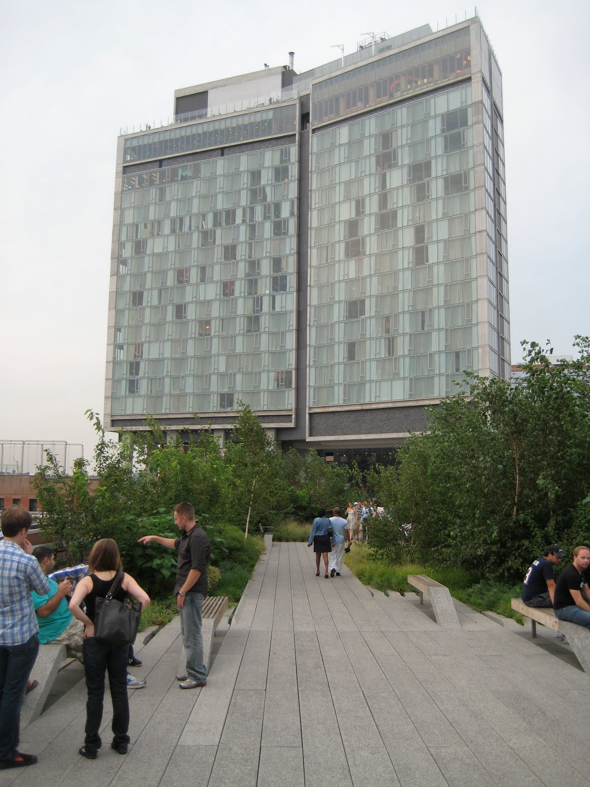
The High Line is surprisingly polarizing to critics. Nicolai Ourrossoff of the New York Times gushed over it, calling it "mesmerizing," "magical," "invaluable and transformative," and "one of the most thoughtful, sensitively designed public spaces built in New York for years." Others, notably CNeal over at his superb blog The Vigorous North, have lamented the loss of wilderness inherent in its transformation to fully functioning park. CNeal also pointed out that while the idea for the High Line came from relatively ordinary New Yorkers, it became a means for the rich and powerful to mold the once gritty landscape of Chelsea into a windfall for developers (much like the ICA on the South Boston waterfront). Meanwhile, the neighborhood is fast transforming into a glittering nest of socialites. The picture above includes the Frank Gehry-designed IAC Building that sprouted in 2007.

While the High Line is certainly a creature of capitalism, my impressions were favorable. I like the juxtaposition of old water towers atop warehouses with brilliant modern creations of glass and steel. The High Line is a distinctive perch, providing a rare vantage point for gazing across at rather than up to the dense layers of urbanism in Chelsea. For me, ascending to the elevated park triggered a memory of climbing up to tree branches, from which I gained a parallel perspective into the canopy of a beech tree.

The design is playful, weaving through several buildings and including an unexpected view down into 10th Avenue that is highly reminiscent of the ICA mediatheque. While I wish there were more traces of the High Line's former industrial function, the architects did leave a few rails embedded here and there in the walkway. The High Line is very much a park, striving to divert rather than explicitly educate.

The High Line succeeds entirely in its ambition. When I visited on a Saturday in August, the park was full but not crowded, and strollers were obviously amused by the unusual point of view. As The Gates did several years ago in Central Park, the High Line is stirring excitement and curiosity about place - the best thing a park can do.

Tuesday, August 24, 2010

Found in the Bronx: Kweenz Destroy

On a Robert Moses pilgrimage last weekend to see exactly how the Master Builder plowed the Cross-Bronx Expressway through the neighborhood of Tremont, my brother and I came across these graffiti.

This shot and the one above, go together. Odd subject matter, I thought.

I know very little about graffiti, or street art as its finer examples are now known (how's this for the SAT - graffiti: street art; comic books: graphic art?!), nor can I claim to have listened to much rap music growing up, but these pieces display a pride in their craftsmanship. They were fresh, hardly relics of the early eighties, and as the paint spread across several blocks of vacant but tidy warehouses, their creators clearly had permission from the owner.

Following the suggested link led me to Indie184, (check out the .net cousin for a good post-modern workout), a rare female graffiti artist. She hails from Washington Heights, is a mother of three, and has several interviews on the web, in which she describes her fashion brand, Kweenz Destroy. My impression of the collection is of hipsters cross-pollinating with the world of hip-hop - American Apparel for the urban set. So much for my excitement at finding a surviving example of graffiti giving meaning to bleak concrete; commercialism has subverted even this quintessential tool of the rebellious. However, give Indie184 credit for honesty, as she responds to a question probing for Bronx hardcore nostalgia by quipping, "Rather corporate than crack any day."

Monday, August 9, 2010

Scaling Up Farmers' Markets

On Tuesday, the USDA released one of the more encouraging news items of the week—figures for the growth of farmers’ markets over the past year. Numbers are up 16% from 2009, nationally totaling well over 6,000. In 1994, when the USDA began collecting the data, there were fewer than 1,800. The top ten states are essentially California and various Midwestern and Northeastern states. Encouragingly, a southern state, North Carolina, has cracked the top ten.

One of the main arguments against localism is its cost—critics charge that paying extra for heirloom tomatoes is inherently elitist. These numbers pretty convincingly refute this contention, however, because the recession, if anything, has accelerated the growth of farmers’ markets. Localism has even ignited a small backlash against the USDA organic label, as I chronicled a few months ago. While it is important to understand how corporate agriculture has exploited the USDA label, the fact remains that the pursuit of customers who pay attention to the label encourages far better farming practices than the conventional norm, not to mention educates people, albeit imperfectly, about the source of their food. In any case, small producers rarely compete directly against corporate organic products, and they can easily get around the difficulty of getting certification by marketing themselves as “beyond organic” (or some such variant). Hence the success of farmers’ markets and CSAs, where the playing field is tilted irrevocably against corporate, large-scale operations.

At this point, with the weekly farmers’ market present in most towns of any size, advocates for local food need to consider how to increase the intensity of consumption of local food rather than its range. Either they need to carve out a larger space for themselves within existing chain stores, increase the demand for co-ops and natural food stores, or, in what to me seems the most promising option, increase their operations where they already enjoy an advantage over potential corporate competitors: farmers’ markets. In short, they should work towards sustaining farmers’ markets that open daily. The best local products, fruit and vegetables, are by their nature highly perishable; shopping once a week simply isn’t enough to enjoy summer’s bounty.

The prime difficulty is finding open space that can be dedicated entirely to markets. Parking lots, which seem to be their most common site, can be spared for a day, but city governments and nearby stores will likely balk at reserving them consistently. On the other hand, markets do bring new customers into an area, and the crowds spill over to shop in adjacent stores, so perhaps an economic argument can be persuasive on this point. Certainly, few small farmers can afford to come to market every day—when would they weed and harvest their produce if they did?—but by sharing stalls with similar vendors, they would provide customers with consistency.

The most tempting alternative for small producers who want to scale up may be to make the leap to supply traditional grocery stores, which reach many more consumers than farmers’ markets. However, these outlets need corporate suppliers because they operate on economies of scale. Small producers are much more vulnerable to the vicissitudes of weather and markets and thus should avoid the long-term contracts that chain stores require (cooperatives change the dynamics entirely). Natural food stores are more favorably disposed to local suppliers, but for whatever reason, growth on the scale of farmers’ markets seems to elude them.

Convening daily farmers’ markets will offer benefits beyond simply higher sales volumes and healthier eating. The more time people spend shopping for food, the better. Farmers’ markets encourage casual interaction, whereas at a grocery, one needs only talk to the cashier (automated checkout are becoming more and more common). Like any point of assembly that encourages conversation, whether church, school, or a sports stadium, the marketplace is fundamental to civics.

Thursday, July 29, 2010

My First Few Days in the Sierra

In My First Summer in the Sierra, John Muir, who had landed a job as a sort of back-up shepherd, described his emotions as the flock began its ascent toward the high country thusly: “Now away we go toward the topmost mountains. Many still, small voices, as well as the noon thunder, are calling, “Come higher.” This, sans wilderness harmony, approximates my own urge to wander in the High Sierra.

I started the trail in Yosemite Valley. Many hikers eschew the first two days of the hike, partly because it is difficult to reserve permits in advance (I bought mine at the Park Permit Office after waking up at 5:30 AM to get a good place in line—it turned out that several backpackers had slept on the office porch), but also because starting two days late in Tuolumne Meadows means avoiding the 6,000 foot ascent out of Yosemite Valley. I found the first couple of days to be brutal but manageable, made far more enjoyable by a Albertan doctor named Joe whom I fell in with. The effort convinced me to cull a number of non-essential items from my supplies while at the Tuolumne backpackers’ campground.

On the third day, I made it to within a mile and half of Donahue Pass, by which the JMT exits the national park. I camped by a sapphire lake at the base of a magnificent glacial cirque, with a panorama of 13,000 foot snowy peaks behind it. But the bugs were astonishingly bad, and not for the first time on the trip. Even with long sleeves, DEET, and a mosquito net over my head, it was astonishingly uncomfortable to be outside. Mosquitoes mixed into my pasta as I was cooking. I worked out a system of backing and rolling into my tent to minimize the amount of time the zipper was open, but I still spent several minutes killing the five or ten mosquitoes that flew in whenever I went in.

In the morning, I got up before the sun crept over the pass so that the mosquitoes, dulled by the nocturnal chill, wouldn’t bother me, and waited to eat breakfast until I reached the pass itself. At 11,000 feet, the winds were too strong for the bugs, and the view stretched north along the valley up which I had hiked and south into the High Sierras. Here indeed was Muir’s “Divine, enduring, unwastable wealth.”

Once out of the felsenmeer, however, the mosquitoes returned, and I never encountered another spot along the trail free of them. Dinner that night, despite a solid day of hiking and good companions, was again rushed, and I couldn’t even find a place to cook breakfast the next day after another dawn rise. On July 19th, 1869, exactly 141 years before, John Muir wrote of “Everything awakening alert and joyful; the birds begin to stir and innumerable insect people.” How he could refer so charitably to the mosquitoes, even while observing “The pale rose and purple sky changing softly to daffodil yellow and white, sunbeams pouring through the passes between the peaks and over the Yosemite doms…” is beyond me. He did at least go on, several days later, to wonder “if any island in mid-ocean is flyless,” also noting that the bugs are “sensitive to cold, and fond of domestic ease.” He was an unconscionable anthropomorphizer: “The whole landscape,” he continued, “glows like a human face in a glory of enthusiasm…” Such was not my visage on the morning of July 19th.

Henceforth the hiking itself was steady, but practically every time I stopped my tormentors descended, preventing me from enjoying the lakes, peaks, meadows, and open pine forests through which the trail wound. So on day five, after notching sixty miles, I stopped at Red’s Meadow Resort for a double cheeseburger and took the bus out to Mammoth Lake. I hate giving up on things, but it seems senseless to continue when relaxation and enjoyment are so elusive. Muir would have been disappointed, but then he reveled in finding a joyful God infusing the landscape—“Divine, enduring unwastable wealth—whereas I was only in search of a pleasant summer vacation.

Nevada Falls at the head of the Yosemite Valley.

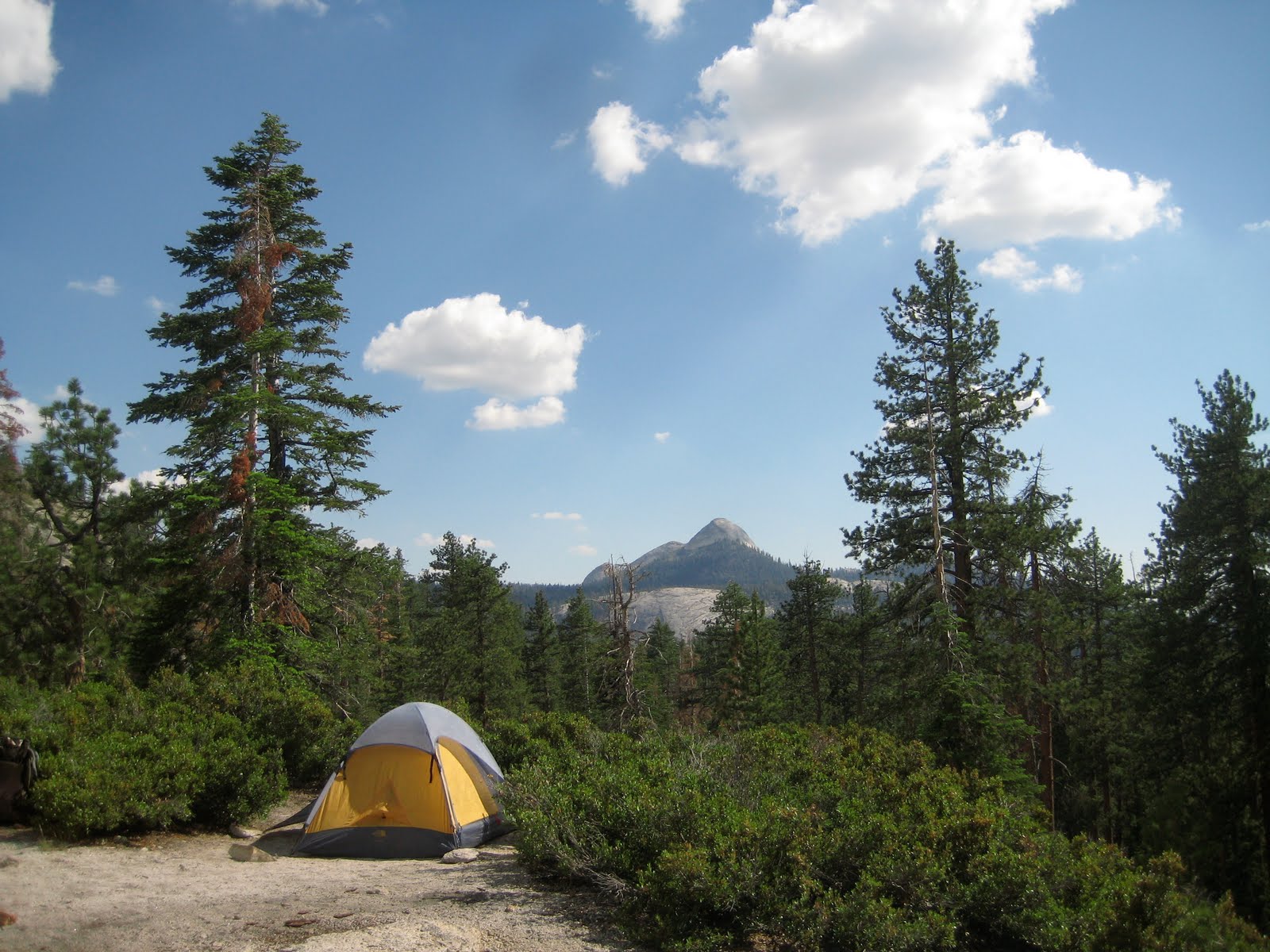
My first campsite, near the Clouds Rest junction. Mount Starr King is in the distance.

Near Donahue Pass.

The pass itself.

Mount Banner, past Thousand Island Lake.

Thursday, July 1, 2010

Across the Ridge

Earlier this week, I hiked up to Madison Springs Hut, where an old college friend, Ari Ofsevit, is working this summer. Nick Anderson, a croomate of mine two years ago at Zealand Falls, had croo switched over for the night - here he is on the Airline, by the lip of King Ravine, to which we scuttled after dinner to take in the sunset.

Madison, the next morning. The hut is to be demolished this fall and rebuilt. Despite its charm, the hut is cramped, and its systems simply do not work very well. Indeed, the plumbing was having fits during my stay. The altitude is too high for composting toilets, and the old flush system has particular difficulty with cold weather. In this picture, Nick is helping the huts manager, Eric Pederson to put up the anemometer on the hut roof. The cook, Carly, happened to be washing dishes at the same moment.

Nick, Ari, Caitlin McDonough - an AMC researcher - and George Heinrichs - another former hutmate of mine from Galehead - headed over to Lakes of the Clouds on my second day. Here, the Gulfside Trail looks almost like a road. Indeed, it was carefully crafted over a century ago by J. Rayner Edmands and a team of Italian workmen he hired up from Boston. Freeze-thaw cycles seem to have broken the treadway less here than along most of the winding path it traverses through the Northern Presidentials.

A dwindling snowbank that looked like the skin of a giraffe.

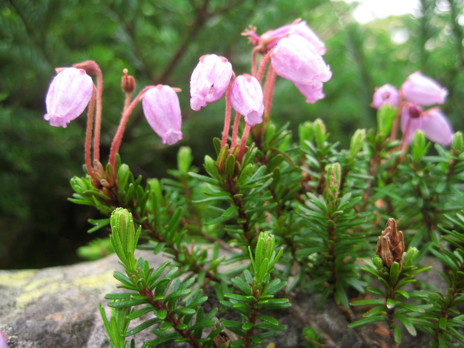
Mountain Heath.

New growth on the alpine balsam.

Monticello Lawn on the southwest flank of Jefferson.

Nick, Caitlin, and George near Sphinx Col.

At the junction of the Gulfside and Westside Trails.

Looking west from Washington towards Bretton Woods.

Traversing across the bulk of Washington, beginning to close in on Lakes.

The sunset that night was spectacular. In some ways, haze is more beautiful at dusk than clear air.

It was hutmaster set at Lakes - every hutmaster in the system had convened at Lakes for three days, ostensibly to mull over the responsibilities of leadership.