Tuesday, August 24, 2010

Found in the Bronx: Kweenz Destroy

On a Robert Moses pilgrimage last weekend to see exactly how the Master Builder plowed the Cross-Bronx Expressway through the neighborhood of Tremont, my brother and I came across these graffiti.

This shot and the one above, go together. Odd subject matter, I thought.

I know very little about graffiti, or street art as its finer examples are now known (how's this for the SAT - graffiti: street art; comic books: graphic art?!), nor can I claim to have listened to much rap music growing up, but these pieces display a pride in their craftsmanship. They were fresh, hardly relics of the early eighties, and as the paint spread across several blocks of vacant but tidy warehouses, their creators clearly had permission from the owner.

Following the suggested link led me to Indie184, (check out the .net cousin for a good post-modern workout), a rare female graffiti artist. She hails from Washington Heights, is a mother of three, and has several interviews on the web, in which she describes her fashion brand, Kweenz Destroy. My impression of the collection is of hipsters cross-pollinating with the world of hip-hop - American Apparel for the urban set. So much for my excitement at finding a surviving example of graffiti giving meaning to bleak concrete; commercialism has subverted even this quintessential tool of the rebellious. However, give Indie184 credit for honesty, as she responds to a question probing for Bronx hardcore nostalgia by quipping, "Rather corporate than crack any day."

Monday, August 9, 2010

Scaling Up Farmers' Markets

On Tuesday, the USDA released one of the more encouraging news items of the week—figures for the growth of farmers’ markets over the past year. Numbers are up 16% from 2009, nationally totaling well over 6,000. In 1994, when the USDA began collecting the data, there were fewer than 1,800. The top ten states are essentially California and various Midwestern and Northeastern states. Encouragingly, a southern state, North Carolina, has cracked the top ten.

One of the main arguments against localism is its cost—critics charge that paying extra for heirloom tomatoes is inherently elitist. These numbers pretty convincingly refute this contention, however, because the recession, if anything, has accelerated the growth of farmers’ markets. Localism has even ignited a small backlash against the USDA organic label, as I chronicled a few months ago. While it is important to understand how corporate agriculture has exploited the USDA label, the fact remains that the pursuit of customers who pay attention to the label encourages far better farming practices than the conventional norm, not to mention educates people, albeit imperfectly, about the source of their food. In any case, small producers rarely compete directly against corporate organic products, and they can easily get around the difficulty of getting certification by marketing themselves as “beyond organic” (or some such variant). Hence the success of farmers’ markets and CSAs, where the playing field is tilted irrevocably against corporate, large-scale operations.

At this point, with the weekly farmers’ market present in most towns of any size, advocates for local food need to consider how to increase the intensity of consumption of local food rather than its range. Either they need to carve out a larger space for themselves within existing chain stores, increase the demand for co-ops and natural food stores, or, in what to me seems the most promising option, increase their operations where they already enjoy an advantage over potential corporate competitors: farmers’ markets. In short, they should work towards sustaining farmers’ markets that open daily. The best local products, fruit and vegetables, are by their nature highly perishable; shopping once a week simply isn’t enough to enjoy summer’s bounty.

The prime difficulty is finding open space that can be dedicated entirely to markets. Parking lots, which seem to be their most common site, can be spared for a day, but city governments and nearby stores will likely balk at reserving them consistently. On the other hand, markets do bring new customers into an area, and the crowds spill over to shop in adjacent stores, so perhaps an economic argument can be persuasive on this point. Certainly, few small farmers can afford to come to market every day—when would they weed and harvest their produce if they did?—but by sharing stalls with similar vendors, they would provide customers with consistency.

The most tempting alternative for small producers who want to scale up may be to make the leap to supply traditional grocery stores, which reach many more consumers than farmers’ markets. However, these outlets need corporate suppliers because they operate on economies of scale. Small producers are much more vulnerable to the vicissitudes of weather and markets and thus should avoid the long-term contracts that chain stores require (cooperatives change the dynamics entirely). Natural food stores are more favorably disposed to local suppliers, but for whatever reason, growth on the scale of farmers’ markets seems to elude them.

Convening daily farmers’ markets will offer benefits beyond simply higher sales volumes and healthier eating. The more time people spend shopping for food, the better. Farmers’ markets encourage casual interaction, whereas at a grocery, one needs only talk to the cashier (automated checkout are becoming more and more common). Like any point of assembly that encourages conversation, whether church, school, or a sports stadium, the marketplace is fundamental to civics.

Thursday, July 29, 2010

My First Few Days in the Sierra

In My First Summer in the Sierra, John Muir, who had landed a job as a sort of back-up shepherd, described his emotions as the flock began its ascent toward the high country thusly: “Now away we go toward the topmost mountains. Many still, small voices, as well as the noon thunder, are calling, “Come higher.” This, sans wilderness harmony, approximates my own urge to wander in the High Sierra.

I started the trail in Yosemite Valley. Many hikers eschew the first two days of the hike, partly because it is difficult to reserve permits in advance (I bought mine at the Park Permit Office after waking up at 5:30 AM to get a good place in line—it turned out that several backpackers had slept on the office porch), but also because starting two days late in Tuolumne Meadows means avoiding the 6,000 foot ascent out of Yosemite Valley. I found the first couple of days to be brutal but manageable, made far more enjoyable by a Albertan doctor named Joe whom I fell in with. The effort convinced me to cull a number of non-essential items from my supplies while at the Tuolumne backpackers’ campground.

On the third day, I made it to within a mile and half of Donahue Pass, by which the JMT exits the national park. I camped by a sapphire lake at the base of a magnificent glacial cirque, with a panorama of 13,000 foot snowy peaks behind it. But the bugs were astonishingly bad, and not for the first time on the trip. Even with long sleeves, DEET, and a mosquito net over my head, it was astonishingly uncomfortable to be outside. Mosquitoes mixed into my pasta as I was cooking. I worked out a system of backing and rolling into my tent to minimize the amount of time the zipper was open, but I still spent several minutes killing the five or ten mosquitoes that flew in whenever I went in.

In the morning, I got up before the sun crept over the pass so that the mosquitoes, dulled by the nocturnal chill, wouldn’t bother me, and waited to eat breakfast until I reached the pass itself. At 11,000 feet, the winds were too strong for the bugs, and the view stretched north along the valley up which I had hiked and south into the High Sierras. Here indeed was Muir’s “Divine, enduring, unwastable wealth.”

Once out of the felsenmeer, however, the mosquitoes returned, and I never encountered another spot along the trail free of them. Dinner that night, despite a solid day of hiking and good companions, was again rushed, and I couldn’t even find a place to cook breakfast the next day after another dawn rise. On July 19th, 1869, exactly 141 years before, John Muir wrote of “Everything awakening alert and joyful; the birds begin to stir and innumerable insect people.” How he could refer so charitably to the mosquitoes, even while observing “The pale rose and purple sky changing softly to daffodil yellow and white, sunbeams pouring through the passes between the peaks and over the Yosemite doms…” is beyond me. He did at least go on, several days later, to wonder “if any island in mid-ocean is flyless,” also noting that the bugs are “sensitive to cold, and fond of domestic ease.” He was an unconscionable anthropomorphizer: “The whole landscape,” he continued, “glows like a human face in a glory of enthusiasm…” Such was not my visage on the morning of July 19th.

Henceforth the hiking itself was steady, but practically every time I stopped my tormentors descended, preventing me from enjoying the lakes, peaks, meadows, and open pine forests through which the trail wound. So on day five, after notching sixty miles, I stopped at Red’s Meadow Resort for a double cheeseburger and took the bus out to Mammoth Lake. I hate giving up on things, but it seems senseless to continue when relaxation and enjoyment are so elusive. Muir would have been disappointed, but then he reveled in finding a joyful God infusing the landscape—“Divine, enduring unwastable wealth—whereas I was only in search of a pleasant summer vacation.

Nevada Falls at the head of the Yosemite Valley.

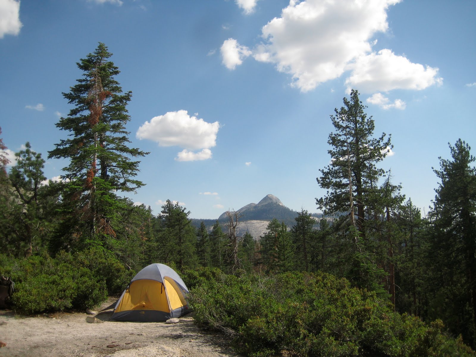
My first campsite, near the Clouds Rest junction. Mount Starr King is in the distance.

Near Donahue Pass.

The pass itself.

Mount Banner, past Thousand Island Lake.

Thursday, July 1, 2010

Across the Ridge

Earlier this week, I hiked up to Madison Springs Hut, where an old college friend, Ari Ofsevit, is working this summer. Nick Anderson, a croomate of mine two years ago at Zealand Falls, had croo switched over for the night - here he is on the Airline, by the lip of King Ravine, to which we scuttled after dinner to take in the sunset.

Madison, the next morning. The hut is to be demolished this fall and rebuilt. Despite its charm, the hut is cramped, and its systems simply do not work very well. Indeed, the plumbing was having fits during my stay. The altitude is too high for composting toilets, and the old flush system has particular difficulty with cold weather. In this picture, Nick is helping the huts manager, Eric Pederson to put up the anemometer on the hut roof. The cook, Carly, happened to be washing dishes at the same moment.

Nick, Ari, Caitlin McDonough - an AMC researcher - and George Heinrichs - another former hutmate of mine from Galehead - headed over to Lakes of the Clouds on my second day. Here, the Gulfside Trail looks almost like a road. Indeed, it was carefully crafted over a century ago by J. Rayner Edmands and a team of Italian workmen he hired up from Boston. Freeze-thaw cycles seem to have broken the treadway less here than along most of the winding path it traverses through the Northern Presidentials.

A dwindling snowbank that looked like the skin of a giraffe.

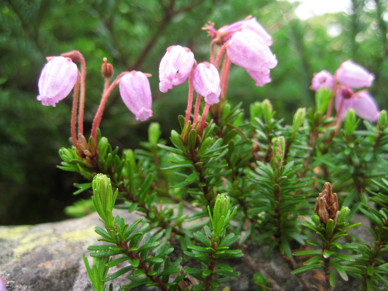
Mountain Heath.

New growth on the alpine balsam.

Monticello Lawn on the southwest flank of Jefferson.

Nick, Caitlin, and George near Sphinx Col.

At the junction of the Gulfside and Westside Trails.

Looking west from Washington towards Bretton Woods.

Traversing across the bulk of Washington, beginning to close in on Lakes.

The sunset that night was spectacular. In some ways, haze is more beautiful at dusk than clear air.

It was hutmaster set at Lakes - every hutmaster in the system had convened at Lakes for three days, ostensibly to mull over the responsibilities of leadership.

Wednesday, June 2, 2010

Mountain Laurel Ball

The ridge of the Shenandoahs is about the last place in Virginia with spring blooms at this point, but what a riot of pink and white it is! I've hiked through Mountain Laurel in the southern Appalachians before and even seen small patches in New Hampshire, but its character is very different in full bloom. Its twisted, gloomy wood and subdued greens give way to a profusion of blossoms. Their delicate shades shift with the sunlight; tablecloth white turns to rich carnation as the sun descends toward the horizon.

I took these pictures last weekend along the Appalachian Trail between the Elk Wallow Wayside and Byrd's Nest #4. We saw a young bear, several deer, and a few thru-hikers making their way north.

Kalmia Latifolia is fond of rocky, hilly slopes and acidic soil, which is why it grows in such profuse thickets in the Shenandoahs. It is quite adaptable, however, and is found all along the Appalachians, from the northern hardwood forests of New England to the heath balds and longleaf pine forests of the Southeast. An opportunist, it tends to thrive in disturbance and may have benefited from the devastation of the American Chestnut by Chestnut Blight in the early twentieth century. Despite its tolerance for shade, it will eventually succumb to lack of light in a mature forest.


This last shot is looking west across the Shenandoah Valley. Two bends of the wonderfully serpentine South Branch of the Shenandoah River are visible.

Saturday, May 15, 2010

Skyline Drive

Logistically, the Shenandoahs are an odd place to hike. They are a long, thin range, with few outlying peaks, and Skyline Drive cuts along near the crest of the ridge for its entire length. Thus it is difficult to avoid encounters with the automobile when climbing any of the taller peaks. Just last weekend, my hiking partner Paul Singh and I emerged from the Bluff Trail onto a dirt road to a find a couple (mother clad in fur) wheeling a stroller. Not far beyond, we arrived at a parking lot where the trail (now part of the AT) crosses the Drive. A license plate read “1derer.”

With the exception of a jaunt up Old Rag, about which word is definitely out, I haven’t encountered many people on trails of the Shenandoahs this spring, even along the AT near the crest of the ridge. Though it is considerably closer to DC than the Whites are to Boston, its perceptual distance seems to be substantial to most Washingtonians. The ranger at the Drive’s gate was quintessentially Park Service chipper about “Wildflower Weekend,” but traffic was light on the road itself. Apparently fall is peak season.

Skyline Drive is here to stay. Built in the thirties, originally under the WPA and with help from the CCC, it is a National Historic Landmark. Entrance costs fifteen dollars, and as two of the park’s four campground were closed last weekend, the park can probably use every penny of the revenue. On the other hand, the 40% of the park that is wilderness is literally all on the mountainsides; the ridge is very much trammeled by man.

In New Hampshire, the closest parallel is probably the Mount Washington Auto Road, though its impact is proportionally far smaller given the size of the Whites. In the thirties, a road to run along the spine of the Presidentials was proposed. Potential construction and maintenance costs were vast, however (alpine freeze-thaw cycles are unkind to asphalt), and the plans were scrapped.

For the casual hiker, Skyline Drive does present an interesting ethical quandary. Should one condemn the road as a biological and geographical intrusion and forgo its offer to relieve tiresome hikes up to the ridge or accept its permanence and embrace the enhanced access?

Last weekend, Paul and I did use the road and had the unusual experience of starting our hike in descent. In fact, our midpoint, a gorge called The Devil’s Stairs, is only served by a trail descending from above that ends at the park boundary. The return across the ridge was mostly in emerald woods, with a few rocky outcrops interspersed. The AT crossed the road several times, giving the hike a rural rather than wild flavor.

Tuesday, May 4, 2010

Shenandoah Spring


Spring seems to be to the Potomac region what fall is to New England. I’ve been doing my best to get into the backcountry over the last couple months, and the Shenandoahs are only a couple hours to the west from DC. They have a bucolic, woody appeal. As with any mountain range within striking distance of the megalopolis, the famous hikes are overrun on the weekends, but much of the range, at least away from Skyline Drive, feels old and left behind. The fields adjacent to the first uplift are still cultivated, but I suspect that the mountains themselves are far more forested than they were a century ago. One path in particular, the Upper Dark Hollow Trail that crosses Broyle’s Gap, must have been built for wagon traffic.

I imagine the old hollows full of hardscrabble subsistence Scotch-Irish farmers, camps of Civil War cavalry pausing after a feint to draw out the troops in the valley, and CCC employees constructing retaining walls and switchbacks to curtail erosion. Old Rag, Mill Prong, Monkey Head—the mountains are saturated with memory. For now, while my affinity for the region is more perceptual than absolute, my imagination is free from the boundaries conferred by experience.